Community

The Concise 2016 Year in Review...Another Good Year!

Professionally

  • ~ 400 maps made...roughly
  • Numerous analyses done, some big, some small
  • Worked for 21 clients
  • Authored Discover QGIS with Locate Press
  • Co-authored Mastering QGIS Second Edition with Packt Publishing
  • Began learning R & working with GeoPackages, getting better at PostGIS/SpatiaLite and brushing up on Python
  • Continued to migrate all GIS work to FOSS4G
  • Connected with a lot of great geospatialists via social networking
  • Taught Community Health Map workshops in: 
    • Seattle WA (twice)
    • Honolulu HI
    • Spokane WA
    • Bethesda MD (twice)
  • Gave talks at:
  • Authored 17 Community Health Mapping blog entries
  • Taught 8 GIS courses at UNM Continuing Education
  • Travelled to: 
    • Seattle (twice)
    • Lawrence KS
    • Raliegh
    • New York City
    • Washington DC
    • Orlando FL
    • Bisbee AZ
    • Spokane WA
    • Honolulu
    • Meeker CO
    • Denver (twice)
    • Red River NM

    Personally

    • Worked out 205 times...20 more than last year!
    • Climbed my 21st fourteener (Mt Bierstadt)...a work in progress
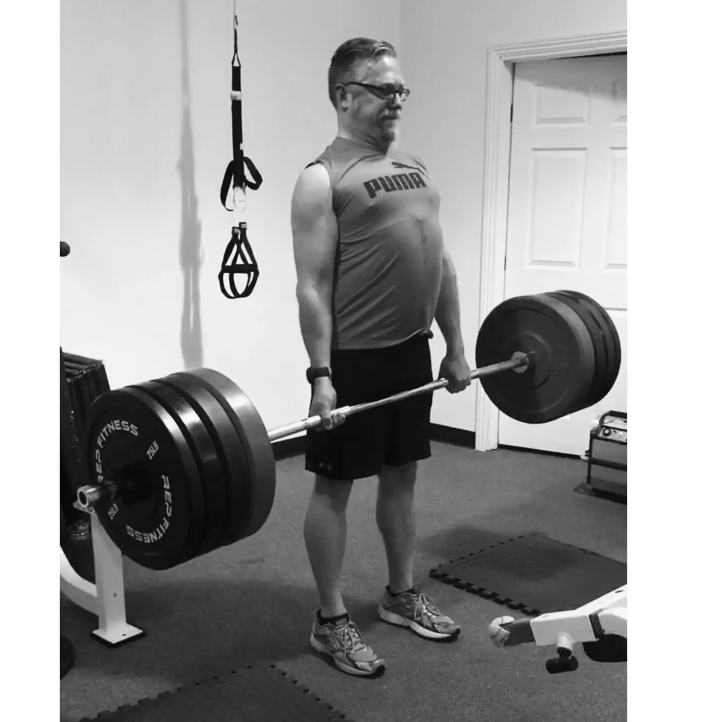
    • PR dead lift – 355lb
    • PR back squat – 315lb
    • Walked 410 miles...ah technology!

    Bird's Eye View Conducts a Training in the South Carolina Lowcountry

    Recently Kurt Menke headed to Charleston, South Carolina to train several groups how to map their communities. This was part of the Community Health Maps project with the National Library of Medicine. This region is also known as the ‘lowcountry’ due to the flat, low elevation geography. The training was hosted by the Medical University of South Carolina (MUSC) and included people from Communities in Schools – Charleston (CISC) and the MUSC School of Nursing.

    MUSC Community Health Mapping Training at the School of Nursing

    First everyone learned how collect GPS field data with iPads. For this we used a new app named iForm. This app was used in lieu of EPI Collect, which no longer supported on iOS.  iForm is an app very similar to the Android app ODK Collect, allowing a custom data collection form to be developed. To practice we collected bike rack locations  and seating areas around the MUSC campus. The afternoon was spent working with everyone’s  data. GPS data points were brought into QGIS and shown against some local Charleston GIS data layers.

    MUSC Data Points in QGIS

    The points were also uploaded to CartoDB. CartoDB is another new component of the Community Health Mapping workflow. It has become more intuitive than GIS Cloud and worked really well. (Note: There will be a post on using CartoDB soon too.)

    The following day I visited CISC’s Derek Toth and three of his students at St. John’s High School on John’s Island, SC. Over a working lunch Mr. Toth showed students how easy it is to collect GPS points with their iPhones. We collecting several points while walking around the campus.

    Mapping the St. Johns Campus

    Afterwards we went back inside and showed them how to upload the points into CartoDB and make a map. The figure below shows the results of 45 minutes worth of work! Click on the map to open the live version.

    St Johns High School Data Points in CartoDB

    This spring these three juniors will be leading the charge to map their island!  They will be presenting their work to the National Library of Medicine later this spring. I look forward to seeing their work!

    The St. Johns High School Mapping Team from left to right: Jocelyn Basturto, Khatana Simmons, Candace Moorer (MUSC), Corrieonna Roper & Derek Toth (CISC)