

The Wallow Fire in Arizona has now burned more than 300,000 acres and is 0% contained. This makes it the third largest wildfire in Arizona history so far. The smoke plume is spreading past the Rio Grande Valley in New Mexico. Visibility in Albuquerque has been reduced to 1 mile or less several times during the last week. Here are some of the more interesting maps I've seen recently.
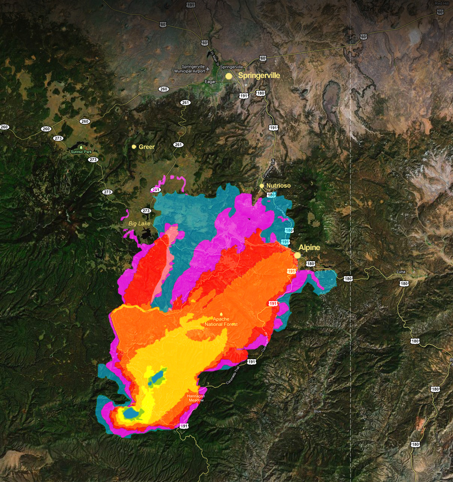
From AZ Central.com here's a fire progression up to June 6th. You can click on the link go directly to the site.
From NASA here is a MODIS satellite image from June 4th showing the smoke plume spreading far into New Mexico. Click on the image to go directly to this NASA site.

From Wildfire Today here is a map of fire danger across the lower 48.
