A day of hiking and birding after a long week of GIS

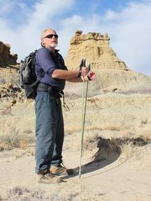
Embudo Canyon HikeAfter a long week at the computer, today I was able to get out and do some hiking in the Sandias! I started out early and headed up the Embudo trail. The trail was quiet and when I reached the seeps from Embudo Spring there were birds everywhere. The assortment of birds included some of the most colorful the Sandias has to offer. The highlights included a both Black-chinned and Black-throated Sparrows, a flock of Western Tanagers, several Yellow-rumped Warblers, an American Redstart, a Plumbeous Vireo and the ubiquitous Spotted Towhees.  Also heard were lots of Canyon and Rock Wrens.  Photos below.  NOTE:  I can't take credit for the bird photos.  I found redistributable photos off of the internet just to pass on the beauty of today's birding trip. 

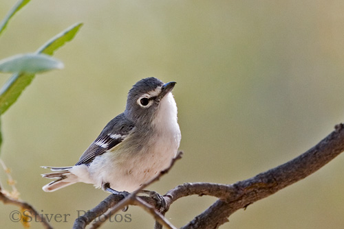
American RedstartPlumbeous Vireo
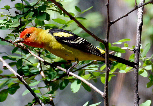
Western Tanager

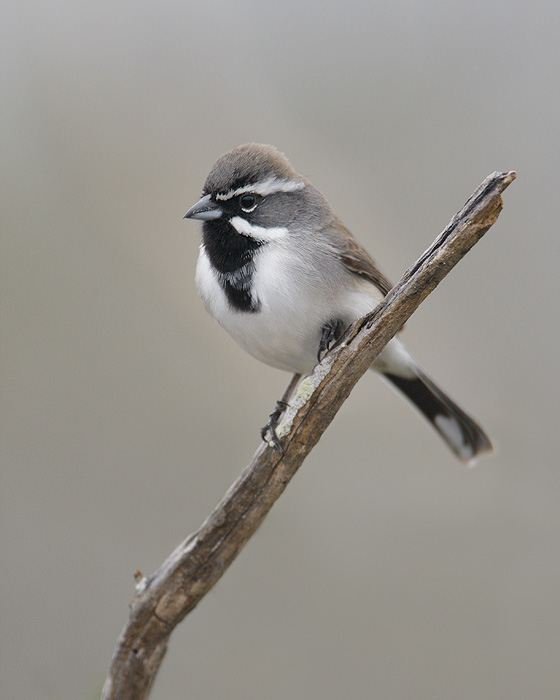
Black-throated SparrowBlack-chinned Sparrow

Will the real Osama Bin Laden compound please stand up.

In the hours after the announcement of Bin Laden's death people scrambled to Google Earth to find the location of Abbottabad, Pakistan and the compound. There were several incorrect guesses, like the example I found below, and posted Sunday night.

Part of the issue was that until yesterday the imagery Google had for the area was acquired in 2001, years before the compound had been built.  Yesterday Google updated their imagery to data acquired on June 14, 2005 (ZDNet).  In the 2005 data (below) the compound can be seen in an unfinished state.

Below is an image of the compound in it's current state from the CIA.

FOSS4G is in Denver this year!

Join us in Denver this fall for the FOSS4G Workshop for Educators.  FOSS4G hasn't been in the U.S. since it was called Open Source Geospatial and was held in St. Paul, Minnesota in 2005.  So it's a great opportunity to learn about the latest in free and open source for geospatial software.  Our workshop will cover the semester long Introduction to Open Source GIS course developed for Central New Mexico Community College (CNM).  That course will run this summer starting on May 24th.  Come learn about QGIS, GRASS, GDAL/OGR, Mapserver and PostGIS!

Bills introduced which would kill the Game & Fish Endangered Species program by eliminating their ability to use federal funds.

HB 567 - STATE RESPONSIBILITY FOR ENDANGERED SPECIES (Rep. Zachary Cook) – This bill would amend the Wildlife Conservation Act, requiring the state to take primary responsibility for listing, protecting, and managing Threatened and Endangered Species in New Mexico.  It would remove authorization for the Commission and the Department to consult with, assist, or enter into agreements with federal agencies concerning threatened or endangered species, and would require a complete investigation process for including any species already listed federally (the Commission could no longer adopt the federal list.)  Identical to SB 565.  Click here to read bill.

SB 565 - STATE RESPONSIBILITY FOR ENDANGERED SPECIES (Sen. William Burt) – This bill would amend the Wildlife Conservation Act, requiring the state to take primary responsibility for listing, protecting, and managing Threatened and Endangered Species in New Mexico.  It would remove authorization for the Commission and the Department to consult with, assist, or enter into agreements with federal agencies concerning threatened or endangered species, and would require a complete investigation process for including any species already listed federally (the Commission could no longer adopt the federal list).  Identical to HB 567.  Click here to read bill.

CALL THE HOUSE ENERGY & NATURAL RESOURCES COMMITTEE MEMBERS AND URGE THEM TO VOTE "NO".

  • Brian F. Egolf, 505-986-4423
  • Antonio Lujan, 505-986-4435
  • Miguel P. Garcia, 505-986-4327
  • Roberto "Bobby" J. Gonzales, 505-986-4425
  • Al Park, 505-986-4413
  • Richard D. Vigil, 505-986-4242

Bighorn Sheep Now Bypassing the Dam Too

The new Hoover Dam bypass bridge includes a wildlife overpass to help protect the state's Bighorn Sheep population. The three sheep bridges cost $4.8 million, a fraction of the price tag for the $71.3 million bypass project. Biologists determined that the sheep prefered overpasses to underpasses because of their keen eyesight and their ability to scope out terrain before approaching it. More from the AZ Republic...

A Bighorn Sheep Crosses the New Hoover Dam Bypass

ESRI International Conservation Mapping Competition

The Conservation of Arctic Flora and Fauna is a working group under the Arctic Council, for the countries of Russia, Denmark, USA, Canada, Sweden, Iceland, Norway and Finland and indigenous peoples.

Created in association with Esri and the Society for Conservation GIS (SCGIS) to bring special recognition to those involved in conservation initiatives, the International Conservation Mapping Competition is open to all nonprofit conservation groups and the individuals who support them. 

Rare Ocelot Sighting - Great News from Southern Arizona

"OCELOTS ARE AMONG the rarest of wild cats and with a territory primarily in South and Central America, it’s uncommon to see them in the States — to the extreme. But in the Huachuca Mountains of Arizona two days ago, a dog chased one up a tree. Experts with the Arizona Game and Fish Department arrived, took photos and verified the sighting. They determined that it appeared healthy enough to be left alone."

Registration now open for the SCGIS 2011 conference

The Society for Conservation GIS (SCGIS) assists conservationists worldwide in using GIS through communication, networking, scholarships, and training.

The 2011 Conference will focus on elements necessary to build strength and capacity in the world of conservation GIS, including healthy partnerships, strong support networks, innovative tools and comprehensive training.

Mike Richie & NMWA protect badland areas in northwestern NM.

"CUBA, N.M. – Many Durangoans have probably sped past here on their way to Albuquerque without realizing the geological marvel they were looking at. The badlands of the San Juan Basin, which radiate across north-central New Mexico, are exposed portions of the Nacimiento formation, a sedimentary layer that began accumulating about 63 million years ago...."