FOSS4G

FOSS4G 2017 Boston

On Sunday the 13th, I flew from Copenhagen to Boston to attend FOSS4G. It was a long flight, and after two weeks it was a transition from Europe to the US. It was also a transition from a small intimate QGIS conference in Denmark, to the biggest FOSS4G ever in a busy part of Boston.  

FOSS4G didn't disappoint. Monday began  with an impressive line up of pre-conference workshops. I took workshops on R, GRASS, PostGIS and Inkscape with QGIS. I was a little delirious from jet lag, but they were all really well paced and well taught. I really appreciated the materials being posted online, because I have more homework to do. Plus as usual I didn't get to attend all the ones I wanted to. 

Regina Obe set up a table for FOSS authors to sell and sign books. Since I was in Denmark, I pre-ordered my books from the publishers and had them shipped to Paragon. I wasn't sure what to expect and didn't want to be left with a ton of books to lug back to New Mexico. As it turned out I should have ordered more. I ordered 10 each of my two books and they almost sold out at the first break. I was really surprised. 

During the week I sat on a panel (What the Heck Does an Open Source Job Look Like Anyway?) with Sara Safavi, Rob Emanuele,  and Katrina Engelsted. Like the conference, the panel discussion went by really fast. I also gave three talks. One talk was on the Community Health Maps initiative I've been working on. For another I presented for a client who couldn't make it. It covered teaching earth sciences with open source GIS. I also co-presented on the State of QGIS with Larry Schaffer. 

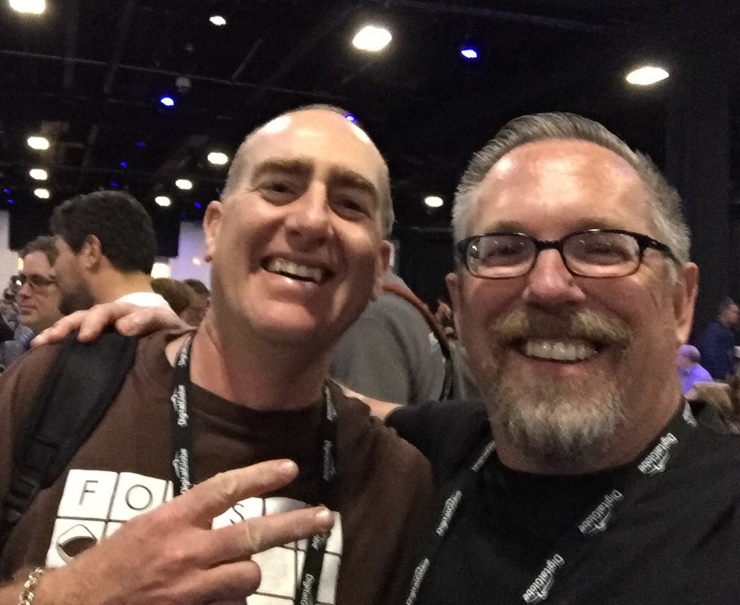
As is usually the case, the people were the best part. It was fun getting to meet new people, people I've known of but never met, and reconnecting with old friends. For example, I was checked into the conference by a client of mine who I'd only spoken with on the phone, and the week kept rolling like that. There were about 6 of us who traveled from Denmark to Boston. It seemed we kept hanging out together in Boston, still in a Nødebo high.

It was a really well planned conference. Everything ran like clock work. There was always someone nearby to help answer a question. Kudos to the conference committee on a job well done! Now I'm about to head out to teach a workshop at Yale and another in Miami. No rest for the weary. Stay tuned!

Apparently It's Conference Season!

I don't think I've ever been to back-to-back conferences and this summer I'm going pretty much back-to-back-to-back. The best part is that they are all in great locations.

First up I'm giving an Introduction to QGIS full day workshop at the Society for Conservation GIS (SCGIS) conference. The location can't be beat. It's at the Asilomar Conference Center, located on the coast just outside of Monterey, California. Historically this has been an esri-centric group so it's an exciting opportunity to show conservationists how far QGIS has come! I've been told the workshop is sold out with a waiting list.

The main presentation hall at Asilomar

The main presentation hall at Asilomar

I'll be home for a little less than a week. Then I head to the 2017 QGIS Users Conference in Nødebo, Denmark! Lene Fischer produced the video below if you want to know where it is and how to pronounce it :)

In Denmark I'll be teaching another all day workshop. This time the topic will be Data Visualization and Cartography in QGIS.  I'll cover the myriad of great data visualization techniques now available in QGIS including the QGIS2ThreeJS and Time Manager plugins. I was there in 2015 for the first QGIS User Conference and it was a great experience...I highly recommend it. The first few days will be the Users Conference, then there is a Developer meeting and it closes the second week with the Workshops. I'll be heading down to Copenhagen in the middle for a few days to be a tourist. 

2015 QGIS Conference in Nødebo Denmark

From Denmark I fly back to Boston for FOSS4G. I'll be participating in 3 talks and a panel discussion. It will be great to catch up with the #gistribe & #spatialcommunity folks face-to-face. After 3 weeks on the road I'll then fly home. It's going to be an adventure. 

I'll post links to my workshop presentations afterwards and I'll probably write a few summaries once I've recovered.

The Concise 2016 Year in Review...Another Good Year!

Professionally

  • ~ 400 maps made...roughly
  • Numerous analyses done, some big, some small
  • Worked for 21 clients
  • Authored Discover QGIS with Locate Press
  • Co-authored Mastering QGIS Second Edition with Packt Publishing
  • Began learning R & working with GeoPackages, getting better at PostGIS/SpatiaLite and brushing up on Python
  • Continued to migrate all GIS work to FOSS4G
  • Connected with a lot of great geospatialists via social networking
  • Taught Community Health Map workshops in: 
    • Seattle WA (twice)
    • Honolulu HI
    • Spokane WA
    • Bethesda MD (twice)
  • Gave talks at:
  • Authored 17 Community Health Mapping blog entries
  • Taught 8 GIS courses at UNM Continuing Education
  • Travelled to: 
    • Seattle (twice)
    • Lawrence KS
    • Raliegh
    • New York City
    • Washington DC
    • Orlando FL
    • Bisbee AZ
    • Spokane WA
    • Honolulu
    • Meeker CO
    • Denver (twice)
    • Red River NM

    Personally

    • Worked out 205 times...20 more than last year!
    • Climbed my 21st fourteener (Mt Bierstadt)...a work in progress
    • PR dead lift – 355lb
    • PR back squat – 315lb
    • Walked 410 miles...ah technology!

    Thoughts on FOSS4GNA 2016

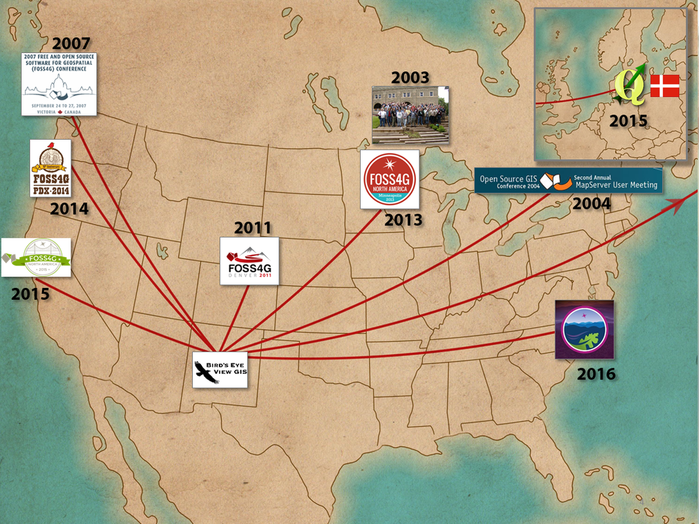
    FOSS4G has been my favorite conference since I attended the first Mapserver meeting in 2003. I've attended each North American installment since then...except for the 2012 NA meeting in DC. I shared about this in my talk Adventures of a Solo GIS Consultant. (The map for my talk is below)

    The 2016 edition FOSS4GNA did not dissapoint. In fact it was one of the best, and not because I fell in love with Raleigh the way I did with Victoria in 2007, or Portland in 2014. Raleigh was nice, but it was more about the conversations between the talks. I loved that the organizers gave us so many long breaks. The rain all week also helped keep me inside :)

    Perhaps it is because I work for myself that being around all these like minded folks is so stimulating. Perhaps it's because I get to meet people I know from Twitter, face-to-face. I loved the moments when I was standing in a group of people and we're all introducing ourselves, by our Twitter handles, like "I'm @spara." Perhaps it's being around some of the smartest people I know. I know it's a little of all of these. FOSS4G is more than the sum of it's parts. I always learn new things, but if that is all it was, I wouldn't keep going back. It's because there is a community of people behind the twitter handles. OsGeo has done a great job of fostering a community with these conferences.

    I met a lot of people I knew from social networking like @sarasomewhere, fellow Locate Press author @PetersonGIS, #gistribe members @gisn8, @UUDreams, @MicheleTobias & @spara. I made some new friends too, like @GuidoS & @TinaACormier, and it is always nice to be able to catch up with people like @rjhale.

    The workshops on Monday were great. I attended the GDAL/OGR workshop taught by Sara Safavi & Sasha Hart and the Getting the most out of QGIS with Python by Chris Daley. Each had a good mix of review and new material. 

    The BoF sessions were a highlight. I sat in on QGIS, #gistribe and Women in GIS. The latter was a great discussion and I really appreciated hearing the experiences women have at FOSS4G and in the workplace. I've seen the numbers of women increasing over the years at FOSS4G, but it was good to hear how it could be more inclusive.

    Of course there were many great talks. Some of my highlights were:

    • State of the QGIS Project by Larry Shaffer
    • Awaken the QGIS Within by Gretchen Peterson
    • Uncovering Ancient Mound Builders Using Open Data and FOSS Software by Calvin Hamilton
    • Cartography with Inkscape by Michele Tobias
    • WTFGL: a beginner's guide to the future of open source web mapping by Lyzi Diamond
    • Empirical Mining of Large Data Sets Help to Solve Practical Large-Scale Forest Management and Monitoring Problems by Bill Hargrove

    I also greatly underestimated the keynote addresses. Each day I'd look at the title and say, "Maybe I can skip this and sleep in, or go get a good breakfast." But I ended up attending each one, and they were all fascinating. Each a little out of the box and provacative in just the right way.

    Thanks to the organizing committee for putting together a great conference. I thought the venue, the session schedule, the food and the communication were all outstanding. 

    FOSS4GNA Raleigh Organizing Committee

    I wish I had the budget to go to the 2nd QGIS meeting in Gerona or FOSS4G in Bonn. Realistically though the next time I'll be able to add to my map is FOSS4G in Boston in 2017. So hopefully I'll see you there!

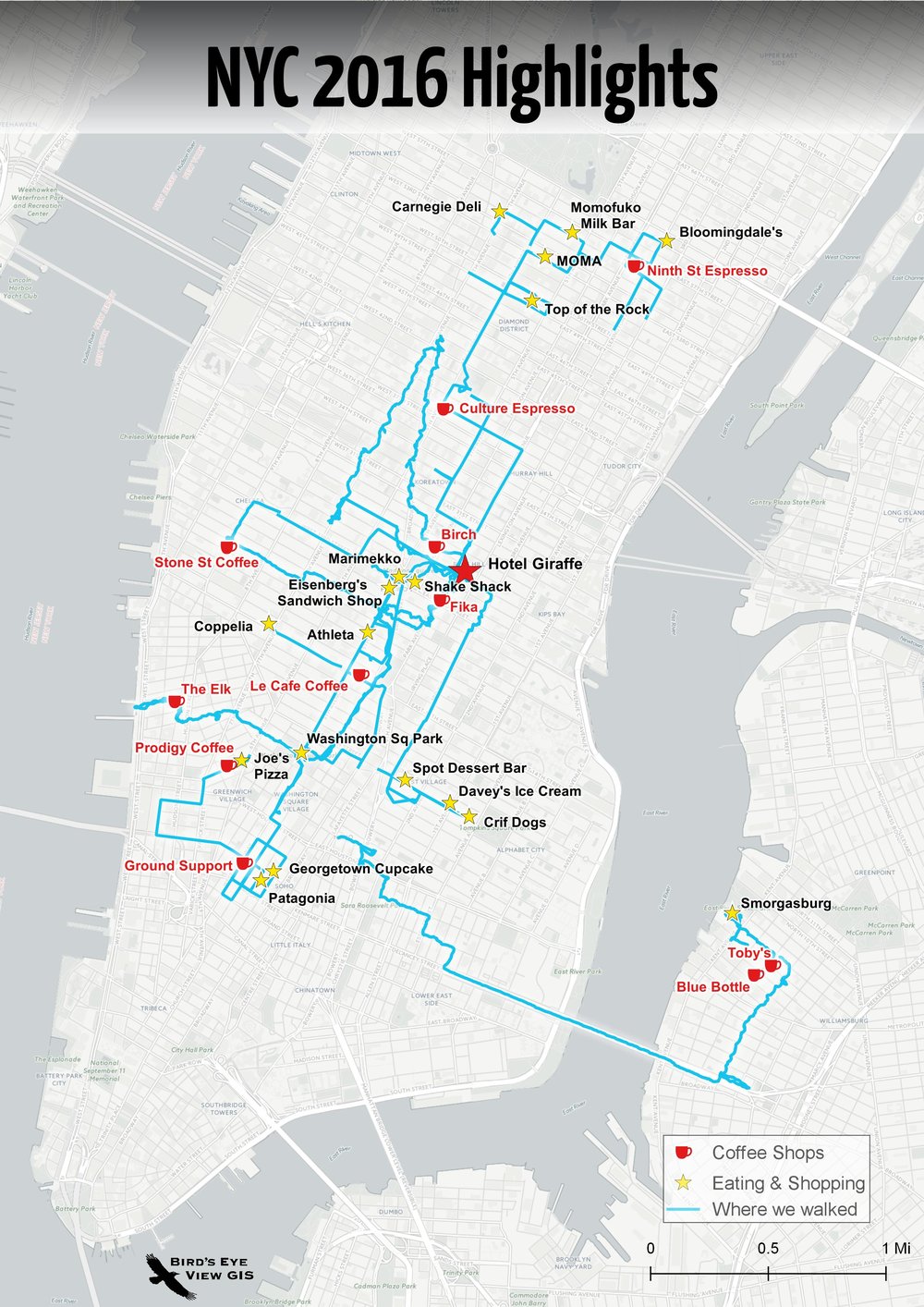
    PS...after FOSS4GNA I met my wife in NYC to celebrate my birthday. NYC didn't dissappoint. The map of our adventures is below!

    Announcement: Learn the new QGIS 2.8.1!

    The GeoAcademy is pleased to announce the launch of their new Introduction to Geospatial Technology Curriculum. The curriculum will be based on the latest version of QGIS, version 2.8.1 Wien which is a long term release (LTR).

    The curriculum is a complete package of five GIS courses leading to a Certificate of Proficiency in QGIS from the Del Mar College continuing education program. The five courses will be offered in a limited-enrollment online class format (25 students maximum), taught by leading GIS professional educators (GISP & PhD) who created the course material. I am one of the instructors.

    The first course, GST 101—Introduction to Geospatial Technology Using QGIS 2.8.1 will begin April 3, 2015 to be followed each month by a new course through August 2015. Tuition is $25 USD per course, or a total of $125 for all five in the Certificate of Proficiency. The courses include:

    1. GST 101—Introduction to Geospatial Technology Using QGIS 2.8.1 (April 2015)
    2. GST 102—Spatial Analysis Using QGIS 2.8.1 (May 2015)
    3. GST 103—Data Acquisition & Management Using QGIS 2.8.1 (June 2015)
    4. GST 104—Cartography Using QGIS 2.8.1 (July 2015)
    5. GST 105—Remote Sensing Using QGIS 2.8.1 and GRASS 7.0 (August 2015)

    Anyone interested in learning more about the offer or enrolling should contact the GeoAcademy director: Phillip Davis at (361) 698-1476 or email:pdavis@delmar.edu

    FOSS4G Academy Launched

    For the first time there is a complete GIS curriculum based on free and open source (FOSS4G) software! Better yet the material are freely available to everyone. The curriculum consists of five courses:

    • GST 101 – Introduction to Geospatial Technology
    • GST 102 – Spatial Analysis
    • GST 103 – Data Acquisition and Management
    • GST 104 – Cartography
    • GST 105 – Remote Sensing

    Examples of FOSS4G Academy QGIS Labs

    The courses were developed via the National Information Security and Geospatial Technologies Consortium (NISGTC), under the leadership ofPhil Davis (Del Mar College). Kurt Menke(Bird’s Eye View), andDr. Richard Smith(Texas A & M – Corpus Christi), authored the material which includes: theory, lecture, labs, data and task oriented video tutorials for each lab exercise.

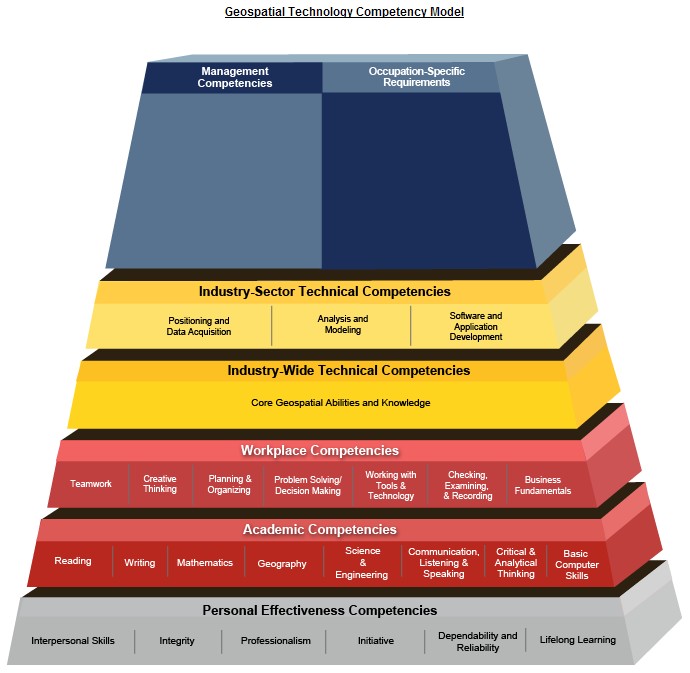
    The courses are aligned with the Department of LaborsGeospatial Technology Competency Model(GTCM). The GTCM  was published in 2010 and will be revised in 2015. It describes the complete set of knowledge, skills, and abilities required by GIS professionals. It is designed around a hierarchical tiered model of knowledge and promotes use of open source technology.

    Geospatial Technology Competency Model

    QGIS is the featured software for all courses. When appropriate other FOSS software’s are also included such as GRASS and InkScape.

    The vast majority of US based colleges and universities use a single vendor’s proprietary GIS software, making this series of courses very unique. In fact it is the first national attempt at a completely open source GIS curriculum. By their very nature of open source software, there is no marketing engine promoting them. This has slowed the adoption and overall use of open source GIS. One hope is that this material will entice people to learn about FOSS4G. Bird's Eye View will be offering instructor led online versions of these courses in the near future.

    The targeted audience is broad and includes:

    • Secondary school educators and students
    • Two and four year college educators and students
    • Students in need of GIS skills
    • Workers seeking to broaden technology skills
    • Anyone desiring QGIS and open source knowledge and skills

    FOSS4G Academy

    The courses are available online at theFOSS4G Academy. Over 2,500 students have already enrolled for these courses demonstrating how in demand these materials are. Visit the FOSS4G Academy now and explore the material!

    FOSS4G-NA 2013

    I just returned from my favorite conference, The North American conference on Free and Open Source Software for Geospatial (FOSS4G-NA). I know it's a mouthful. But it's a gathering of the brightest FOSS4G developers (aka geeks), and has a friendly atmosphere of collaboration and openness.  It covered two and a half days and included: pre-conference workshops, multiple plenary sessions, five concurrent paper sessions, lightning talks, code sprints, a Gala Event, panel sessions, and birds of a feather sessions. It was my first time in Minneapolis since the inaugural 2003 Mapserver Users Meeting and it was nice being back. 

    One day standing in line for lunch I met two guys who were also in attendance 10 years ago, but we'd never met before. It was the guy in front of me and the guy directly behind me. We ended up eating together. What are the odds of that? It's those little moments of connection that make these events so much fun.

    This year I noticed an even more distinct focus on web mapping technologies, and web development, than usual. With QGIS 2.0 just about to release it would have been great to hear a state of QGIS talk. I'd also really appreciate more sessions on spatial analysis. Maybe I'll need to sign up for one next time. After all there is more to geospatial than web development.

    The opening plenary was one of the highlights. Erek Dyskant covered use of FOSS4G technologies behind the Democratic National Committee's recent presidential campaign. A stack of FOSS4G software was developed including PostGIS, QGIS and web services. This stack allowed access to current campaign related data in near real time to all nationwide staff. Field offices were then in a great position to prioritize door knocking and calling campaign, and maximize resources.

    Another session of note had an educational focus with papers titled: The New Users, Adapting Web Mapping Curriculum to Open Source Technologies, and Building a Geospatially Competent Workforce with FOSS4G. This was especially interesting for me as I strive to keep my Introduction to Open Source GIS and Web Mapping course current in a rapidly changing field. I also heard valuable updates on MapServer, GeoServer, MapBox, OpenGeo, GDAL/OGR, Leaflet and OpenLayers 3.

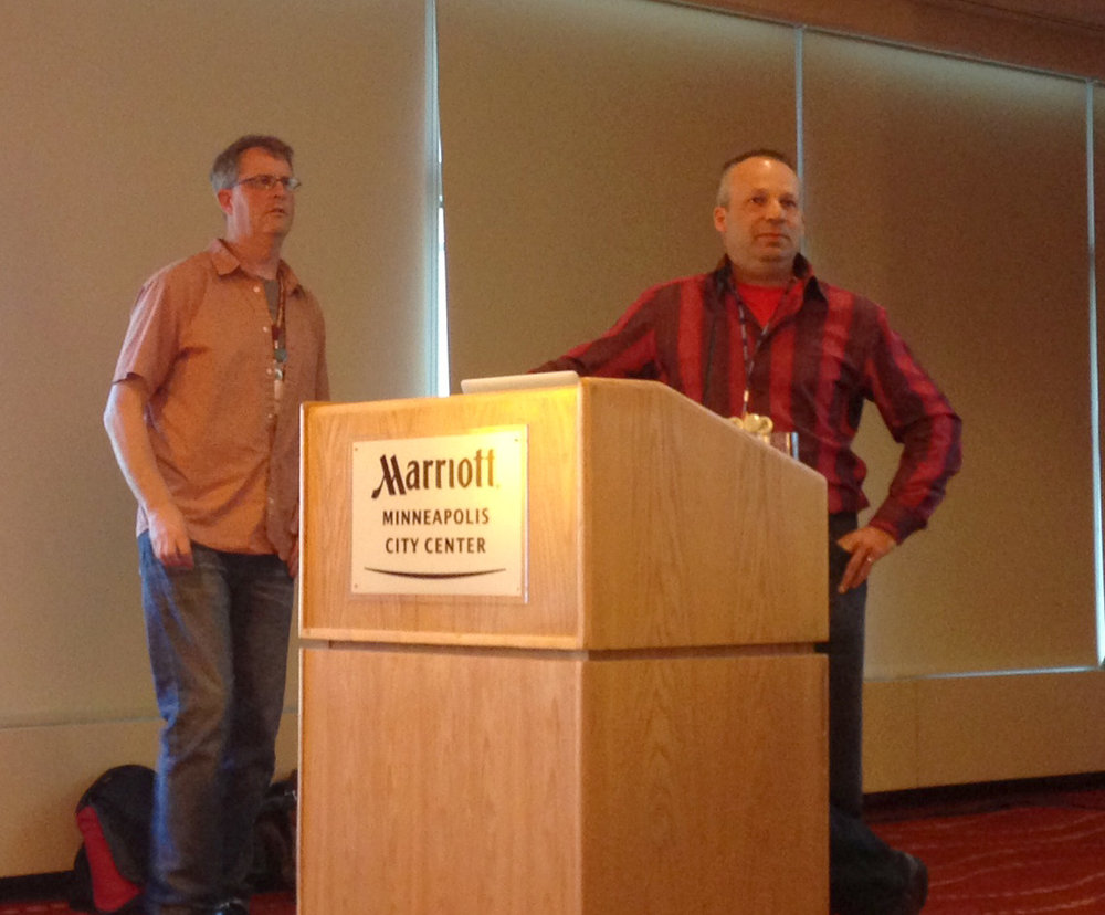
    Steve Lime and Daniel Morissette answering questions about MapServer

    The final session was a panel discussion on the use of FOSS4G in state and local governments. It was an interesting frank discussion. On one side it was about the political and bureaucratic hurdles in the way of organizations adopting FOSS4G. On the other were success stories of FOSS4G being utilized in state governments.

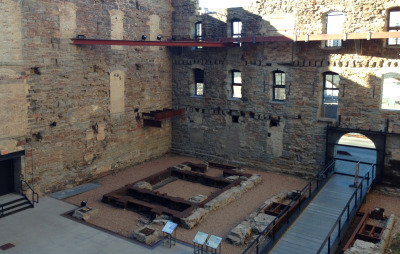
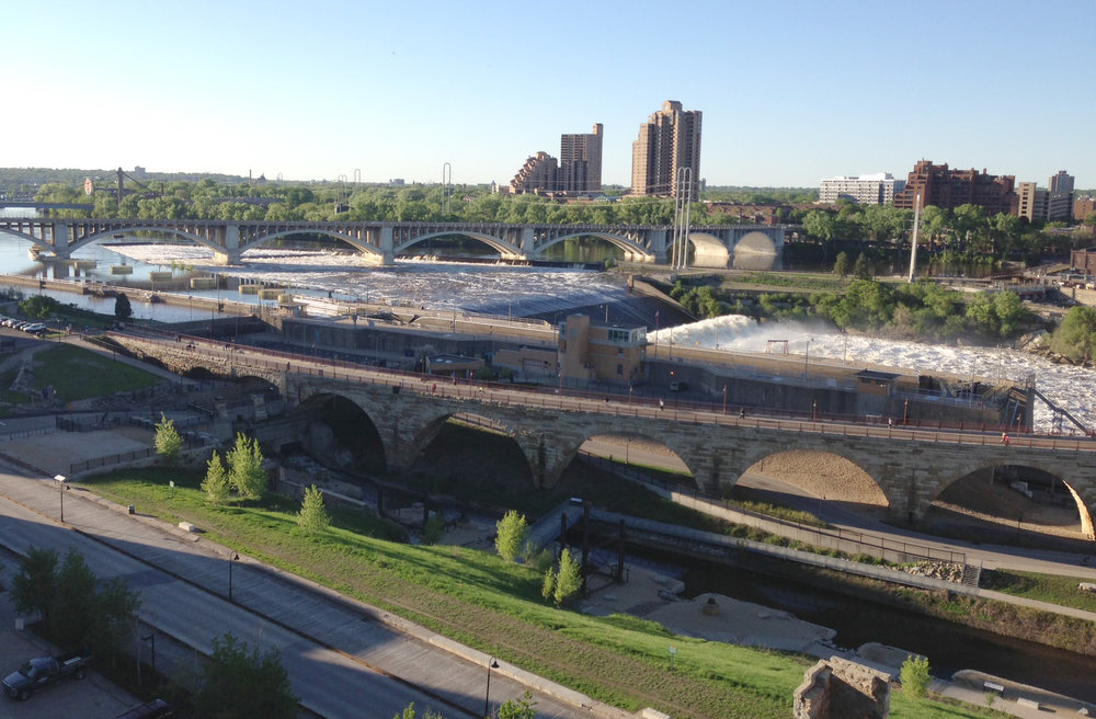
    The Gala was held at the Mill City Museum in the ruins of the Gold Medal Flour mill on the Mississippi River. A gorgeous site. Seeing voluminous water is a treat coming from drought stricken New Mexico.

    The ruins of the old Gold Medal Flour Mill

    The view of the Mississippi River from the 8th floor of the old mill.

    Plus I met a bunch of new folks! Kudos to the organizers for putting on another great show. It was a great conference!

    ************************************************************

    END NOTE: If you're a geo-geek and into exercise you've got to get a Suunto Ambit. Here is the data from my walk back to the conference hotel from the Gala Event. I wasn't wearing my heart rate monitor, but it still collects elevation, barometric pressure, GPS, elevation, speed, temperature etc., and allows export to KML. Oh and you can navigate with it and it has a compass. 

    My walk back to the hotel from the Gala event recorded with my Suunto Ambit GPS watch

    Fear, Uncertainty and Doubt

    There are two factors that stop people from exploring or adopting free and open source (FOSS) GIS software. The first is fear, uncertainty and doubt (FUD). While it's true that corporations, such as Microsoft, have used FUD as a marketing strategy (purposely spreading FUD about OS software), FUD regarding FOSS GIS software is now commonly spread by GIS users themselves. I don't think this is intentional. Rather, it can be counterintuitive for people who have grown up in a competitive capitalist society to understand why anyone would create and use free software.

    Initially people often wonder:

    • How can I make money using FOSS software?
    • Why would anyone create FOSS software, what's in it for them? 

    The other main factor is unfamiliarity. Over the last two summers I've taught a semester long course called, Introduction to Open Source GIS at the local community college. The GIS program at my school, like most, is ESRI-centric. A majority of the students are very surprised to learn about the broad array of FOSS GIS software. Once exposed to FOSS software, such as QGIS, they ask, "Why doesn't everyone use it?" It comes down to a combination of these two factors.

    In full disclosure, I also use ArcGIS almost every day. However, I also utilize all the leading FOSS GIS software. I consider them all valuable tools in my toolkit. One of the nice features of FOSS GIS software is that it's free. So there is absolutely nothing preventing you from downloading a FOSS GIS package and trying it out. If it doesn't meet your needs just uninstall it. My hope is to inspire people to do exactly this.

    This year the FOSS4G Conference is in Denver, CO and very accessible to those of us in the USA. The timing couldn't be better to learn more about FOSS4G. While FOSS GIS software has been around since the 1980's, recent years have seen the software becoming much more mature and user friendly. There are great FOSS GIS products for the desktop, web server, web client, spatial database and mobile GIS. There are now intuitive Windows installers for all the leading packages.

    So, if you have questions like:

    • What is free and open source software?
    • What FOSS GIS software is out there?
    • Is it really free?
    • Does it work?

    you should sign up for the Introduction to Geospatial Open Source at this year's FOSS4G conference

    Hope to see you there!

    FOSS4G Workshop for Educators at FOSS4G

    This fall Bird's Eye View (with the support of the GeoTech Center) will be holding the FOSS4G Workshop for Educatorsat the Free and Open Source Software for Geospatial Conference (FOSS4G) in Denver, Colorado. This is exciting for at least two reasons. Having the FOSS4G Conference in North America, let alone the United States, is fairly uncommon. In recent years it has been held in Australia, South Africa and Spain. Secondly, the workshop will premier one of the only FOSS GIS curricula in the United States. Entitled Introduction to Open Source GIS and Web Mapping, it is currently being taught at Central New Mexico Community College.

    Free and  open source software comprises one of the fastest evolving sectors of GIS. While FOSS GIS software has been around since the 1980's, recent years have seen the software becoming much more mature and user friendly. There are great FOSS GIS products for the desktop, web server, web client, spatial database and mobile GIS. Historically, ease of access and installation has been a major hurdle for those wanting to transition to FOSS GIS software. Now there are intuitive Windows installers for all the leading packages.

    The course is expected to become increasingly important to the CNM program. In New Mexico, employers are starting to favor applicants with knowledge of both ESRI and FOSS applications. This is in part due to the economic times. Students at CNM and elsewhere learn GIS in pure ESRI environments. Most are shocked to discover how many capable FOSS GIS software packages exist.

    The course sticks to a pure FOSS paradigm. For example, assignments and lectures are provided in Open Office versus Microsoft Office. The students are not introduced to much new GIS material in the course, save web mapping. Rather they are shown how to do things they have learned in other foundational courses using FOSS GIS software. The packages used include: Quantum GIS, GRASS GIS, GDAL/OGR, SpatiaLite, PostgreSQL/PostGIS, and MapServer. They are also introduced to open standards and open data. Midway through the semester they are given a final project assignment. For this they research a FOSS GIS package not being covered in the course lab, and during  the last week of class they present their findings to the class. This exposes the students to a large number of new tools.

    The web mapping portion is an introduction to web mapping and the web in general. Part of the overall goal for the course is to make it accessible to students who have completed the Introduction to GIS course. So, this course has no programming requirement. Google maps (although no open source) is used as a gentle introduction to web mapping. Then students move on to labs where they use MapServer to create basic web mapping applications.

    The workshop this fall will target educators wanting to incorporate FOSS GIS into their curricula, or those who are just curious about what FOSS GIS is and what it can do. The course goals, readings, labs and exam structures will be shared. Attendees will also get to try their hand at a lab or two. For more information visit the conference workshop page.

    FOSS4G is in Denver this year!

    Join us in Denver this fall for the FOSS4G Workshop for Educators.  FOSS4G hasn't been in the U.S. since it was called Open Source Geospatial and was held in St. Paul, Minnesota in 2005.  So it's a great opportunity to learn about the latest in free and open source for geospatial software.  Our workshop will cover the semester long Introduction to Open Source GIS course developed for Central New Mexico Community College (CNM).  That course will run this summer starting on May 24th.  Come learn about QGIS, GRASS, GDAL/OGR, Mapserver and PostGIS!